|
The ITME Field Station (2002
- 2009)
|
| |
 |
|
ITME
HQ & Field Station N 15
21.948' W 61 23.842' (+/-
5 m)
|
| |
|
Location
|
|
|
|
ITME's
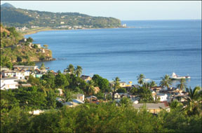
field station and teaching center was on the west coast of
Dominica, 10 km to the North of the capital Roseau. Perched
on the heights of Mahaut, which are also known as Belfast,
the school overlooks a picturesque bay opening into the Caribbean
Sea. Mahaut is a bustling village full of contrasts. While
the school was surrounded by a quiet residential area, the
coastal road is lined by a vibrant fishing community. The
field station was a perfect base of operations for field work
throughout Dominica, conveniently situated near the main cross-insular
roads that connect the western and eastern side of the island.
|
 |
|
| |
| Features |
|
The
facilities included a lecture rooms (2), lab space, computer room
/ reference collection, office space, student union/cafeteria, and
dorm-style accommodations for 25 persons. Efficiency units (1-2
bedroom apartments) are also available for small research teams.
|
|
   
|
|
   
|
    |
|
Balconies
and terraces offered quiet space for reflection or studying. Meal
plans are provided during the semester and summer programs and on
demand for visiting groups and researchers. ITME provided transportation
to and from research sites around Dominica. Internet services (wifi
and ethernet terminals) were available.
|
     |
| |
| Life
at the Field Station |
|
The
station operated like a mini-campus. Faculty and most of the teaching
staff lived on site and partake in the day-to-day operations of
the station. Academic work is arranged in alternating days of lectures
and field labs, from Monday through Saturday. Full immersion into
the scholastic challenges, as well as a strong commitment to communal
living arrangements were expected from every participant.
|
 

|
|
Students
had access to a tennis court, a soccer and cricket field, and a
basketball court at the DCP sports facility. The bus stop is only
a 5 minutes walk from the station and adjacent to the nearest beach.
The capital Roseau can be reached in 20 minutes, most other destinations
on the island within one hour by bus.
|
|
GREEN
CAMPUS: ITME's operations and services were designed and implemented
with the intent to support local farmers and fishermen, and to minimize
the station's negative environmental impacts and its "carbon
footprint".
|
| |
|
The
ITME Fleet
|
|
|

|
|
ITME
T1
excursion truck
7-10 passengers |
ITME
T2
tour mini bus
10-14 passengers
|
ITME
T3
expedition truck
17-20 passengers |
|
|
|
|
The
ITME Field Station (2000 - 2001)
at the Springfield Plantation
|
|
|
|
|
|
The Setting for ITME's Academic Programs |
| |
Dominica's
western shore faces the Caribbean Sea and harbor beautiful fishing
villages. The eastern shoreline is more rugged, facing the Atlantic
Ocean with its direct impact of the Trade Winds.
|
|
|
The
island's volcanic nature is also reflected in its submarine topography.
Coral reefs are nestled along the edges of steep slopes, and underwater
sulfurous springs can be found a few meters from shore.
|
|
|
ITME
faculty and students are currently focusing their attention on
the documentation of flora and fauna of Dominica's coral reefs.
This work includes, but is not limited to, detailed inventories
of benthic invertebrates, the study of reef community structure,
and year-round observations on coral diseases and mortality.
|
|
|
|
|
Commonwealth of Dominica ...Caribbean's
last wilderness. |
| |
|

Dominica
is among the youngest volcanic islands of the Lesser Antilles.
It first emerged from the sea some 26 million years ago
and has been sculpted by the elements to its current beauty.
The Caribe Indians, whose ancestors were among the first
settlers of the island, call it Waitukubuli, meaning "tall
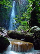
is her body." High peaks are covered by montane and elfin
vegetation, while primary rain forest and an abundance of
clean and often cascading rivers characterize slopes right
down to the sea. This is home for several endemic species
like the Sisserou Parrot depicted in Dominica's code of
arms.
The
spectacular scenery on land is paralleled in the ocean where
coral reefs line steep drop-offs, making Dominica a renowned
destination for divers and nature lovers around the world.
Whales also visit these deep blue waters and can often be
seen from shore.
|
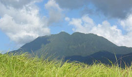
Dominica's
volcanos have been silent for the past 1000 years, but sulfur
springs above and below the sea, and The Boiling Lake are
signs of its connection to volcanic hot spots deep under the
ocean floor.
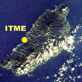
All
of this and more was explored by students and staff in the
course of the ITME project. The field station, located on
the West coast, served as base of operations for field research
and excursions carried out throughout the island.
Dominica's
70,000 inhabitants enjoy all the amenities of modern living,
yet a calm pace drives daily life. The colorful agro-industry
of this tropical "treasure island" strongly influences the
pulse of the local community and ranks it among the friendliest
in the Caribbean.
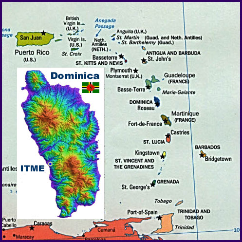
Dominica,
located between Guadeloupe to its north and Martinique to
its south, is easily reached from the USA and Europe. Daily
flights via San Juan, Antigua, St Lucia, Barbados or Guadeloupe
provide a variety of choices for travel to and from Dominica.
|
|
| |
|
Commonwealth of Dominica ...in the heart of
the Eastern Caribbean |
| |
 LOCATION:
Eastern Caribbean. (1,400 mi from Miami, FL)
LAND
AREA: 750 km2
TOPOGRAPHY: very mountainous
POPULATION: 71,200 in 2001
MAJOR CITIES & TOWNS: Roseau (capital), Portsmouth
NATURAL ATTRACTIONS: secludede
beaches, coral reefs, dolphins and whales, rain forests,
water falls, endemic species, sulfur
springs, boiling lake, |
|
|
|
 |
|
Dominica
Topography Map by Dr. Ian C.F.Stewart at stewgeop@senet.com.au
|
| |